
Examining the changing inluence of global wildfires using new satellite observations of carbon monoxide
Background
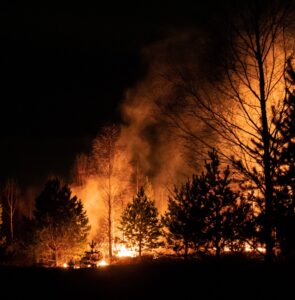
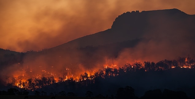
Wildfires play an ancient and vital role as part of Earth’s carbon cycle, but as humanity intensified its expansion across the planet’s biosphere, the effects of fires have been increasingly destructive, costly and damaging to health and livelihoods. Whilst wildfires have long been an important source of renewal across ecosystems, there is an increasingly man-made contribution to their causes, locations and severities, both directly and indirectly, through the effects of climate change. Recent evidence indicates that globally, the area burned by fires has decreased, particularly in tropical regions (Andela et al., 2017). However, the frequency and intensity of fires in vulnerable regions in higher latitudes are thought to be increasing (Ellis et al., 2021). Recent large events in Australia, Southeast Asia, Russia and Canada have highlighted how devasting the effects of these fires can be.
During incomplete combustion, wildfires release a range of trace gas species to the atmosphere, particularly carbon monoxide (CO). Monitoring the concentrations of CO in the atmosphere can therefore indicate the location and severity of burning events. Monitoring by satellites since the turn of the millennium shows that global CO concentrations were decreasing through the late 2000s but have since levelled off (Buccholz et al., 2021). Regionally, the picture is more complex, with high uncertainty on most emissions estimates. However, recent novel satellite data have provided additional coverage with sensitivity down to the Earth’s surface and this data has not yet been widely exploited.
Aims
This project aims to investigate the following research questions:
- How have global and regional atmospheric CO concentrations, and the sources and sinks of CO, varied in recent years?
- How can we exploit our understanding of CO sources to better understand the drivers of biomass burning in different ecosystems?
- What does this imply about the future of wildfires under anthropogenic climate change?
- How is the global carbon cycle currently affected by biomass burning?
Methods
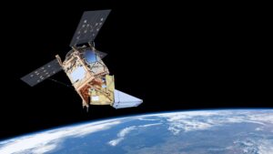
This project uses novel satellite data, state-of-the-art atmospheric models and statistical estimation methods. Launched in 2017, the TROPOMI instrument onboard European Space Agency’s (ESA) Sentinel-5P satellite, provides high resolution CO-monitoring capability with excellent sensitivity near the surface. These data have not yet been comprehensively exploited to quantify CO emissions from fires and other sources. Additionally, the research will employ the TOMCAT chemical transport model, which has been extensively used to simulate the complex atmospheric transport and chemical processes for numerous species including CO (e.g. Pope et al., 2021). TOMCAT will allow assessment and comparison of the current best estimates of CO emissions from all sources to TROPOMI and other observations.
This work will additionally make use of TOMCAT’s inverse modelling framework (Wilson et al., 2014). Data assimilation methods optimise surface sources so that the model representation of atmospheric CO best matches observations. This provides extra constraint of the fire-related emissions estimates in line with what was observed in reality. A new ‘nested’ high-resolution grid module will allow for detailed regional analysis of fire emissions and focus on how tropical regions (e.g. central Africa, Southeast Asia) respond to the significant global El Niño event that is likely during the 2023/24 fire season.
Linking CO fire emissions to overall carbon loss through emission ratios for different ecosystem types will allow for investigation of the overall global carbon budget, with data assimilation of multiple atmospheric species such as methane (CH4) and carbon dioxide (CO2) improving our understanding of the biosphere’s carbon balance.
Throughout, the PhD researcher will be provided with necessary observational data and have access to High Performance Computing (HPC) platforms to carry out model simulations and data processing. Guidance will be provided by a panel with extensive expertise on all relevant techniques. The researcher will also have access to the broad range of expertise from across the UK’s National Centre for Earth Observation (NCEO) through the supervisory group.
This innovative project will use novel satellite data and state-of-the-art modelling and data assimilation techniques to probe the Earth system’s response to human activity and climate change. It has significant potential for high-impact outcomes through the combination of data assimilation techniques and high-resolution observational data, pushing the boundaries on open questions regarding the behaviour of global fires in a warming world.