
Do heatwaves increase rock fall risk?
Project Summary
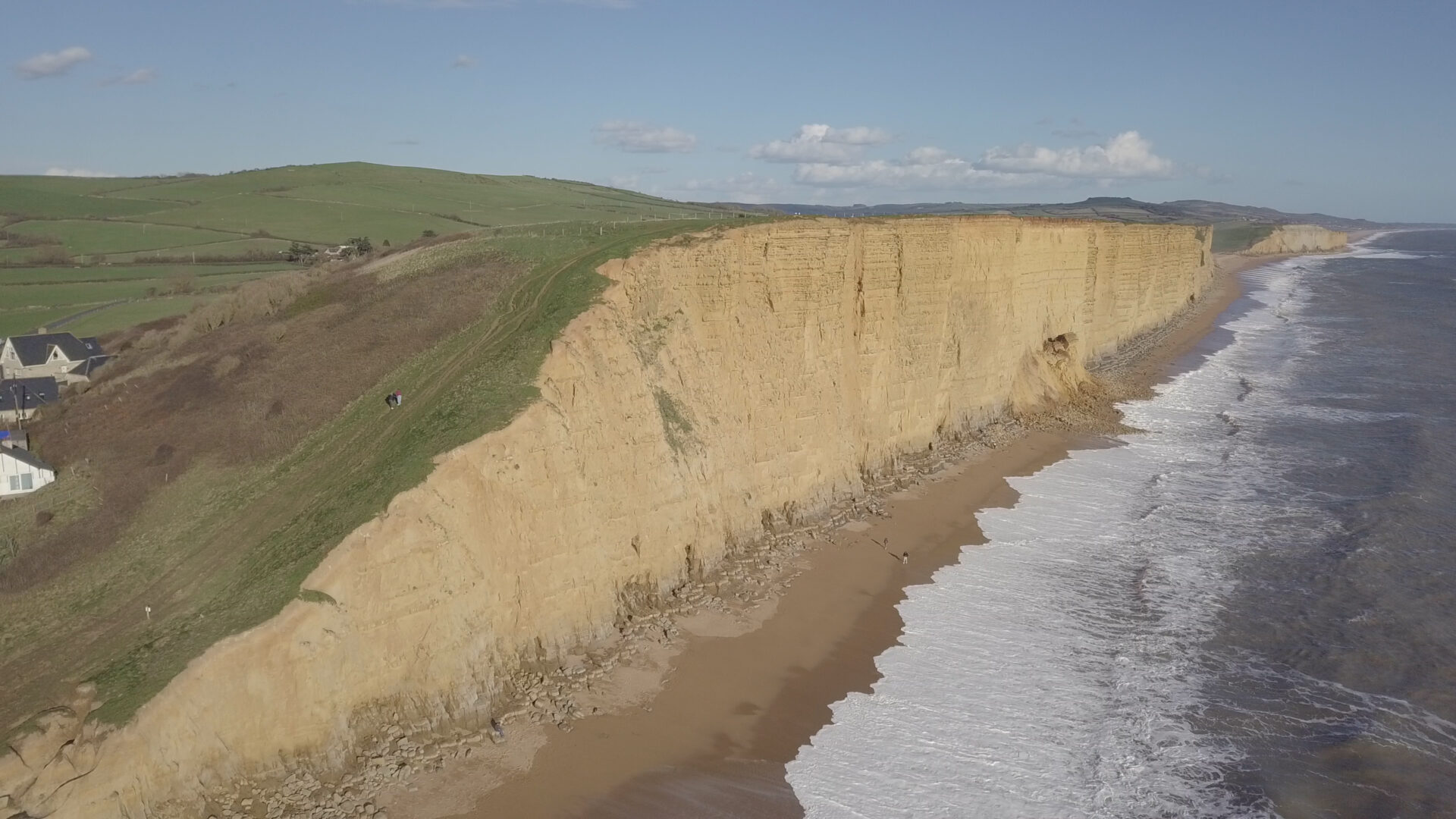
The southwest coast of Dorset is one of the most landslide-active regions in the UK. Coastal processes, including wave erosion, rainfall, and temperature variations may all contribute to increased rock fall activity along coastal cliffs. The British Geological Survey (BGS) typically warns the public of increased rock fall potential during heatwaves. The increase in rock fall activity and the increase in coastal visitors during hot periods may be leading to an increase in public risk. This is concerning given the increased number and duration of heatwaves in the UK (e.g. 84 heatwaves since 2000 compared to 44 between 1960 and 2000). This project aims to investigate the link between cliff deterioration processes and temperature variation using a combination of UAV thermography, UAV LiDAR, and potentially in-place sensors. The proposed area of interest is in Dorset, but could extend to other coastal areas. Results from the study will inform risk management practice and inform public safety communication for coastal areas and/or transportation infrastructure exposed to rock slopes.
Advancing understanding of rock fall triggers
Quantitative data to discover the link between increased temperature and rock fall could be invaluable for understanding rock fall hazard and communicating the potential impacts to the visiting public. This link, however, has yet to be well understood. Rock fall triggers include seismic events, precipitation, freeze-thaw action, and anthropogenic activity. Rock falls may also be triggered by extreme heat or cyclic thermal variation of the rock’s surface temperature. Temperature changes can cause expansion and contraction of the rock surface which may be driving fracture propagation and rock fall activity. This process has been demonstrated in granitic exfoliation sheets in Yosemite National Park, for example, but has yet to be fully understood for a range of rock mass types.
Project Approach
This project will involve the use of state-of-the art remote sensing tools such as UAV LiDAR and UAV thermography to characterise and monitor coastal cliff sites with a range of geological characteristics. Potential study sites could include rock slopes in West Bay Dorset, Staithes North Yorkshire, and a variety of potential sites in Scotland. By monitoring cliff temperature distribution it may be possible to gain insights into cliff weathering processes, areas of seepage, intact and fractured zones, and other processes characterised by anomalous temperatures. Expansion and contraction of the rock and any rock fall activity may be measured through repeat UAV LiDAR surveys of the cliffs during targeted monitoring campaigns.
There may also be an opportunity to install slope instrumentation as an extension of the 5G Rural Dorset Project, which would allow a longer time-series monitoring of the of the rocks temperature and/or deformation of the cliffs.
The PhD will involve:
It is expected that the candidate will bring their own expertise and design their own research questions surrounding the influence of heatwaves on rock cliff deterioration. The project will generally involve the following:
- Geological and thermal characterisation of target rock cliffs.
- Design of monitoring campaigns to first develop an understanding of the thermal behavior of cliffs through diurnal heating/cooling cycles. This will be followed by targeted monitoring of periods of high heat and/or thermal variation. This will involve access to UAV thermal imaging and LiDAR systems, and appropriate processing software, supported through partnership with the BGS.
- Developing an understanding of public risk surrounding rock cliffs. Including modelling which rock mass types are prone to heatwave-induced rock falls as well as the behavior of the public exposed to the hazard.
- The project may also be supported by thermal modeling of rock cliffs.
Candidate Profile
The candidate should have a background in geosciences or related field (e.g. engineering geology, physical geography). Some programming skills would be an asset (e.g. Matlab, Python). This project will be based in the School of Earth and Environment where the candidate will have full access to collaborative research groups, training courses, and in-house seminars.