
Quantifying Spatial Variations in the Geomechanical Properties of Hydrothermally Altered Volcanic Domes Using Hyperspectral Imaging
Volcanic lava domes often experience extensive hydrothermal alteration and recent studies have quantified how significant hydrothermal alteration can alter the strength and other geomechanical properties of volcanic material (e.g. Heap et. al., 2022, Schafer et. al, 2023). Previous studies have largely focused on the mechanical testing of individual samples or analysis of individual domes and not on the extensiveness of these changes in properties. However, hyperspectral aerial imagery has recently been shown to reliably map areas of clay minerals as indicators of hydrothermal activity (Miller et. al, 2000) which have been correlated with geomechanical characterisation (Shafer et. al. 2023).
This project will look to combine large-scale observations of space-borne hyperspectral imagery with geomechanical testing and spectroscopy with the aim of determining whether it is possible to rapidly profile the alteration state of a dome and the distribution of its geomechanical properties.
The ability to conduct such assessments at scale is important as changes in the geomechanical properties of volcanic domes have been previously been linked to collapse, resulting in potential debris avalanches or volcanic activity, posing significant risk to surrounding populations. The project will investigate previous sites of failure in an attempt to create a pseudo cross-section of properties.
The four objectives of this project are:
- Develop methods to process hyperspectral data for detecting hydrothermal alteration.
- Use spectroscopy to quantify mineralogical changes from identified alteration, truthed against chemical and mineralogical analysis.
- Build a database of geomechanical properties for altered and unaltered dome materials, useful for constraining dome behaviours.
- Model spatial distributions of alteration and properties for stability analysis of volcanic domes.
The project objectives will be achieved through a combination of field, laboratory and Numerical Modelling work split into three stages.
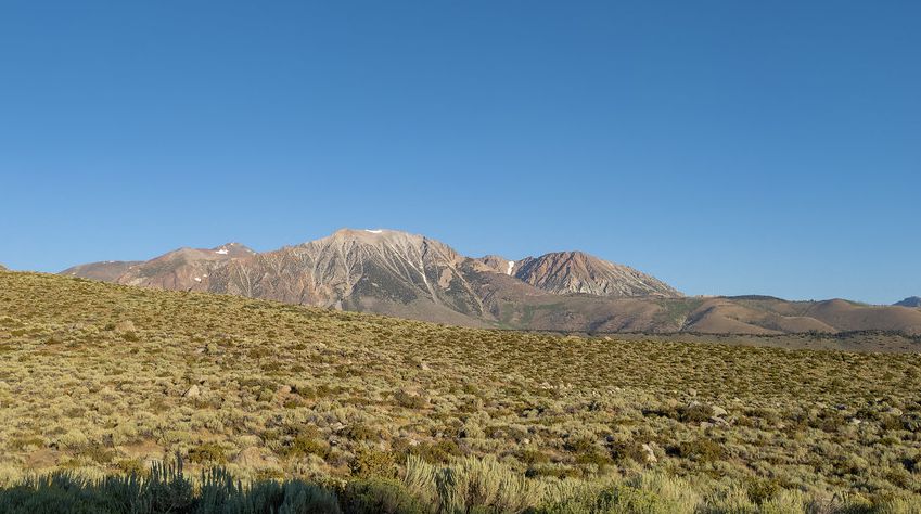
The first stage of the project will be a thorough investigation of field sites for suitability, with example candidates being The Mono-Inyo craters, a series of mainly rhyolitic domes and craters in the Sierra Nevada range of Eastern California, USA or the Pululahua dome complex, a collection of sixteen dacitic-andesitic lava domes located in Ecuador. Conditions will alter significantly at the location of different dome complexes in terms of dome compositions, age, degree of weathering, climatic conditions and ground cover. The viability of space-borne hyperspectral imagery in these differing settings will need to be established starting with an assessment of ASI’s PRISMA medium-resolution hyperspectral satellite imagery.
The second stage of the project will involve sample collection followed by spectroscopy, mineral characterisation, and geomechanical testing. Spectroscopy will involve powder XRD characterisation to identify the clays present and their modal abundance, and SEM analysis to look at the spatial distribution of identified phases. The geotechnical testing will be undertaken in the Rock Mechanics Engineering Geology and Geotechnical Laboratory (RMEGG), utilising a CONTROLS advance test automatic test system, which will allow the determination of the full Mohr coulomb failure envelope as well as the Young’s Modulus and Poission’s ratio. The RMEG lab will also be used to determine additional geomechanical properties such as unit weight and porosity which will be correlated with the SEM imaging. During the field work stage there will be the possibility to collect additional, localised, drone based imagery for further comparison with the medium scale satalite-imagery to asses the effect of image resolution on the ability to detect the heterogeneity seen in the field. This will be highly dependent on the filed site identified as being most appropriate for the other areas of the project.
The third stage will involve incorporating the data obtained from the hyperspectral imagery and laboratory testing into two and three dimensional geomechanical models that will be used to assess the ability to accurately identify and map hydrothermally-altered volcanic material, and from that to assess implications for overall dome stability. This modelling will be conducted using limit equilibrium and finite element applications from the Rocscience suite of geotechnical software.
This project will provide new techniques for rapidly assessing the spatial distribution of hydrothermal alteration as well as quantifying the impact of that alteration for volcanic hazard and risk. The results will improve hazard forecasting and risk management for potentially dangerous volcanic dome collapses.
Relevant references.
Heap, M.J., et al. Journal of Volcanology and Geothermal Research, 428, 107576 (2022).
Miller, C. et al. Journal of geophysical research: Solid Earth, 125(2) (2020).
Schaefer, L.N., et al. Bulletin of Volcanology, 85:43 (2023).